Links
Park Links
Joseph D. Grant County Park
Grant Ranch History
Grant Park Map
Santa Clara County Parks
Bay Area Ridge Trail
Friends of Santa Teresa Park
High-Dynamic Range Photography
HDR Experiments -1
HDR Experiments -2
HDR Hellyer Sunset
HDR Uvas Canyon Waterfalls
HDR Santa Teresa Park
Ron Horii's Outdoor Photography Pages
Pictures of Joseph D. Grant County Park,
January 31, 2010
On January 31, 2010, I went to Joseph D. Grant County Park. I took pictures of the pig damage around the parking lots, then went to shoot around the ranch houses. Afterwards, I hiked up the hills on the west side of the park, hiking up the Dutch Flat Trail to the Heron Trail, then back down to the Dairy Trail, Brush Trail, and San Felipe Trail. I brought my new lightweight tripod with me to take some HDR pictures.
These are HDR (High Dynamic Range)
pictures taken around the ranch house area. These were taken
using multiple shots taken at different exposures to capture the wide
range of brightness in the pictures. There were combined using special
software. See the links to the left for more about HDR photography.

Old ranch building

Bridge over San Felipe Creek
leading to the Grant Ranch House. The deep shade of the creek and the
bright white fence and ranch house are particularly difficult to
capture at the same time with conventional photography. HDR imaging
brightens up the shady areas and tones down the bright areas so both
can be seen.

The Grant Ranch House. HDR imaging brightens up the shady lawn and tones down the bright white building.
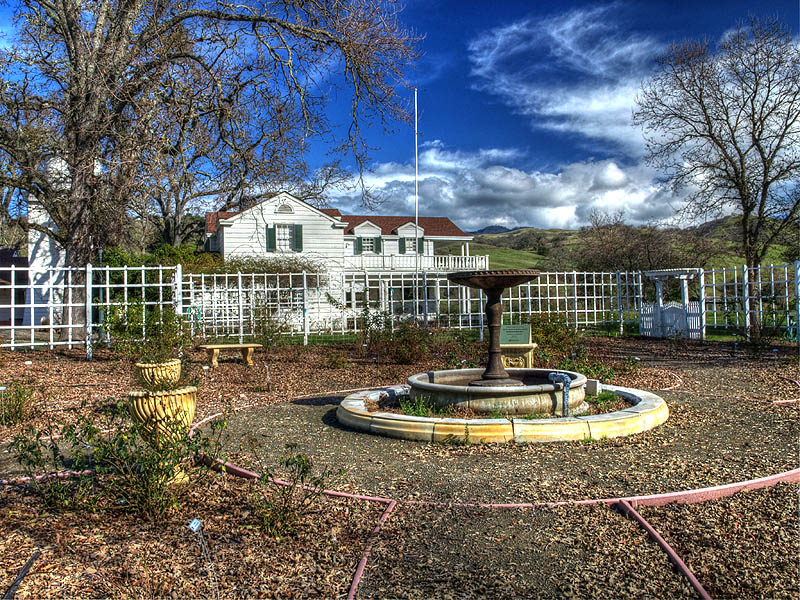
Garden and fountain by the Grant Ranch House

Tankhouse, ranch house, and garden

Pond and water tanks by the ranch house

Old ranch building, with Mt. Hamilton in the background
HDR Picture on the Trails:

By the Lower Dutch Flat Trail

By the Lower Dutch Flat Trail

Pond near the junction of the Dutch Flat and Dairy Trails

Bay laurel trees on the Heron Trail

Pond on the Dairy Trail

Pond near the junction of the Dairy Trail and Brush Trail

Pond near the junction of the Dairy Trail and Brush Trail
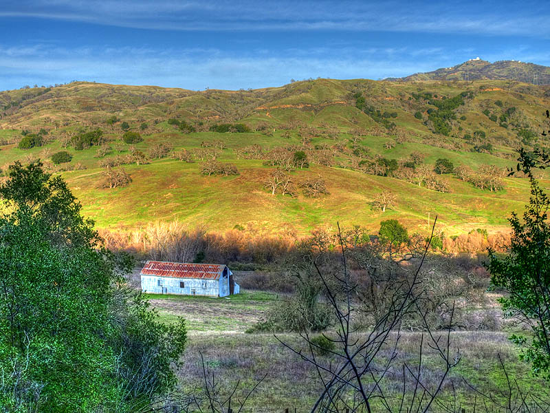
Snell Barn and Mt. Hamilton from the Brush Trail
Conventional Pictures

Equestrians near the horse camp, with Lick Observatory on top of Mt. Hamilton in the background.

Well near the Grant Ranch House

Hikers on the Lower Dutch Flat Trail

View from the Lower Dutch Flat Trail looking southeast down Hall's Valley.

View of Grant Lake from the Heron Trail

View of Hall's Valley, Mt. Hamilton Road, and Mt. Hamilton from the Heron Trail

View of Mt. Hamilton and the Lower Hotel Trail from the Brush Trail
Pig Damage
Grant Ranch has a problem with
feral pigs. They come out at night and root around lawns and trees
looking for grubs, worms, roots, and bulbs.

Lawn by the well near the ranch house

Lawn near the horse camp

Looking back towards the parking areas west of the ranch house

Across from the horse camp
Damage to the Grant Ranch House

Earthquake damage to the chimney

Woodpeckers have been pecking holes in the sides of the house.

Woodpecker holes in the water tank.
Page created by Ronald Horii,
2/9/10